


The geophysical and geological map of Kasta Hill
The designing of the geophysical and geological map of Kasta Hill was started on November 11th, 2014 and opertations were conducted by fragmentation due to unfavorable weather conditions.
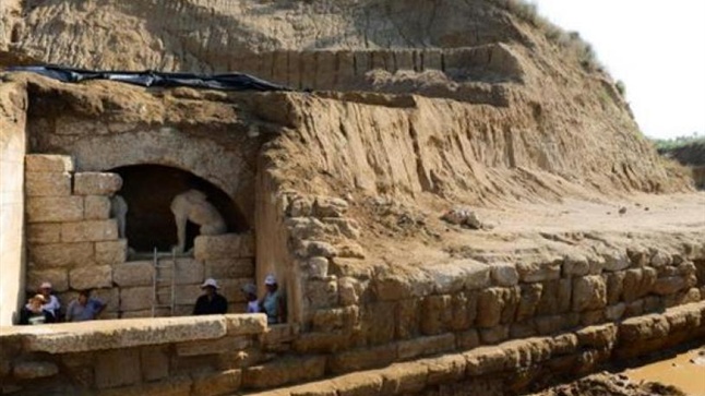
The geophysical survey unveiled the interior of the hill where static structures were identified, which were further investigated. In one case at the north of the dome, the removal of soil revealed that the subsurface structure was illustrated with electrical scans. This case is shown in picture.
The geophysical survey unveiled the interior of the hill where static structures were identified, which were further investigated. In one case at the north of the dome, the removal of soil revealed that the subsurface structure was illustrated with electrical scans. This case is shown in picture.